

ハイウェイ交通情報
1M+
App information
- Name:
- ハイウェイ交通情報
- Category:
- Maps & Navigation
- Safety:
- Not verified
- Price:
- Free
- Developer:
- NEXCO西日本情報テクノロジー
- Download:
- 1M+
Screenshots



About
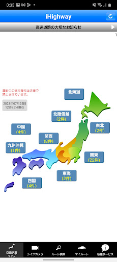
iHighway provides real-time traffic data for expressways nationwide. It is ideal for drivers planning long trips, helping them avoid road closures and congestion. For example, a driver can use it to check current conditions before departing, ensuring a smoother and more predictable journey.
What Stands Out
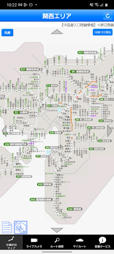
- View current traffic conditions, including road closures and congestion, on an interactive map updated every five minutes.
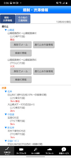
- Receive email notifications for road closure reopenings, helping you stay informed about route availability.
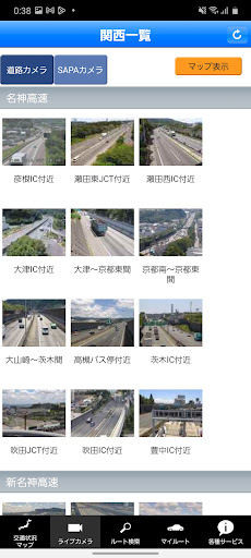
- Access live camera feeds to visually assess expressway and service area conditions before you travel.
- Utilize the 'My Route' feature to save frequent journeys and receive one-tap updates on relevant traffic alerts.
Things to Consider
An internet connection is required for iHighway to function; it does not work offline. Some features, like road closure work information and heavy rain/snowy road alerts, are specific to the NEXCO West Japan area and its operating seasons. Users should verify regional availability.
Useful Tips
- Save your common driving routes in the 'My Route' feature for quick access to current traffic information.
- Enable email notifications for road closures and reopenings on your registered routes to stay proactively informed.
- Check the live camera feeds before starting your journey to get a visual confirmation of road and rest stop conditions.
- Review the traffic map regularly for real-time updates on congestion and unexpected road closures during your trip.
More Apps
 ビックカメラShopping★ 5.01M+
 손목닥터9988Health & Fitness★ 5.01M+
 ScottishPower - Your EnergyHouse & Home★ 5.01M+
 調整さんProductivity★ 5.0100K+
 PrestaCOPFinance★ 5.050K+
 YouVersion BibleBooks & Reference★ 4.9100M+
 Question.AI - Chatbot&Math AIEducation★ 4.95M+
 Centi PRO - Currency ConverterFinance★ 4.91K+
 Word Search ExplorerWord★ 4.95M+
 Collage Maker | Photo EditorPhotography★ 4.9100M+
 Panera BreadFood & Drink★ 4.95M+
 StardustTV - Movies & DramasEntertainment★ 4.9500K+
 Waymo OneMaps & Navigation★ 4.91M+
 PopeyesFood & Drink★ 4.95M+
 CHANI: Your Astrology GuideLifestyle★ 4.950K+
 Al Quran (Tafsir & by Word)Books & Reference★ 4.95M+
 ColorNote Notepad NotesProductivity★ 4.9100M+
 SpeedwayFood & Drink★ 4.95M+
 Bubble Level - Level ToolTools★ 4.91M+
 MPCTravel & Local★ 4.91M+
 Marriott BonvoyTravel & Local★ 4.910M+
 ArriveCANTravel & Local★ 4.95M+
 LimeTravel & Local★ 4.910M+
 GIF Sticker & WAstickerSocial★ 4.95M+
 漢字辞典Books & Reference★ 4.9500K+
 ChewyShopping★ 4.910M+
 EventbriteEntertainment★ 4.910M+
 Vita MahjongBoard★ 4.9100M+
 NPRNews & Magazines★ 4.85M+
 7-ElevenFood & Drink★ 4.810M+